Golden Week observation of mode water mixing: Shinsei-maru KS-25-4 Cruise
(May 2025, Takeyoshi Nagai@A02-4)
The Kuroshio Current, which flows along the south coast of Japan, leaves the Japanese coast at Cape Inubo and flows eastward, which is called the Kuroshio Extension. In the southern part of the Kuroshio Extension, convective mixing caused by cooling of the sea surface during winter occur in the surface layer, mixing seawater vertically and producing a thick layer of uniform temperature, salinity, and other properties. As this water gradually sinks into the interior of the ocean, the surface layer heated up during spring covers and caps the top 100 m, separating this vertically uniform seawater in the ocean interior from the surface. This thick layer of uniform seawater trapped in the sub-surface layer of the subtropical ocean is called “subtropical mode water”.
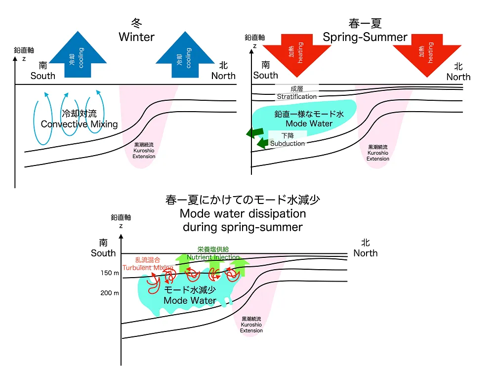
Because subtropical mode water occupies a large volume in the North Pacific Ocean, it plays an important role in heat and carbon transport and in controlling climate. Once a portion of subtropical mode water sinks to the subsurface, it takes several years before it is exposed to the surface again, thus trapping carbon dioxide absorbed through the ocean surface during the winter months and sequestering it from the surface for long periods of time. In addition, subtropical mode waters contain relatively high levels of dissolved nutrients that are essential for phytoplankton growth. Therefore, vertical mixing of seawater between this sub-surface subtropical mode water and the warmer seawater of the overlying cap will warm the upper end of the mode water and reduce the thickness of the uniform mode water. At the same time, if mixing causes nutrients in the mode water to seep to the surface and phytoplankton proliferate with them, the zooplankton and other organic matter that prey on them will increase, and their carcasses may settle and inject additional carbon into the mode water.
Continuous observations of mixing intensity are essential to determine the extent of vertical mixing between this mode water and the warmer water above it and its biochemical effects. However, since vertical turbulent mixing is only enhanced when storms occur in the ocean during the spring and summer months, it is extremely difficult to observe this from a vessel. If we can continuously observe turbulent mixing and biochemical parameters such as nutrients in the ocean interior with autonomous floats that raise and lower vertically in the ocean, we can quantify the degree to which mode water and the warm ocean water above it are vertically mixed and what impact this has on the ecosystem.
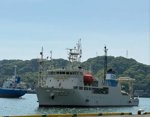
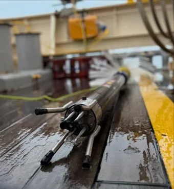
In the R/V Shinsei Maru KS-25-4 cruise (PI: Shota Katsura, Tohoku University), multiple autonomous biogeochemical observation floats, autonomous turbulence observation floats and the research vessel were used for water temperature, salinity, alkalinity, pH, phytoplankton, nutrients and turbulence observations. From the A02-4 group of Habitable Japan, the turbulence measurable float (NKE PROVOR CTS5-FloatRider float) of TUMSAT is deployed.
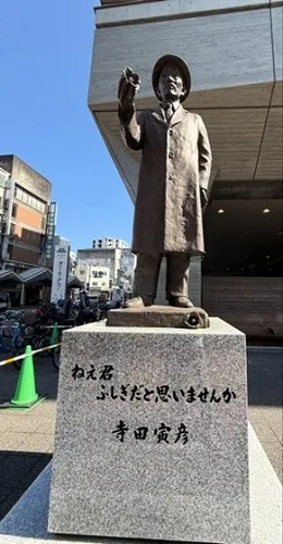
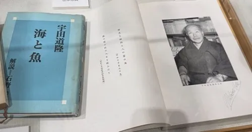
Since the observation equipment was loaded in Kochi before this cruise, we were able to walk around the Kochi port area before departure. Kochi has produced many famous scientists. These include Dr. Tomitaro Makino, a botanist who served as the model for the main character in a morning TV series; Dr. Torahiko Terada, a physicist and oceanographer who worked also on the phenomenon of fluid convection, which is also important for mode water formation; and Dr. Michitaka Uda, an oceanographer and fishery oceanographer who was a student of Dr. Terada and a professor at the author’s alma mater. There is a bronze statue of Dr. Torahiko Terada outside the library near where I stayed, and I was able to see an exhibition booth of scientists from Kochi on the fifth floor of the library.
We left Kochi Port on May 2, 2025 and turned our course toward the Pacific Ocean with Katsurahama Beach in the distance. After setting sail, we were forced to make a major revision to our plan due to less-than-ideal weather during the observation period. There were four autonomous floats to be deployed on this cruise, and two of them needed to be recovered during the cruise. Therefore, there was a possibility that two of the floats would not be deployed if the recovery could not be predicted with any certainty.
So, to escape from the stormy weather, we waited behind Hachijo-jima Island from May 3-4, during which time we tested two floats, including one brought in by the author, with our float and a rope attached to a buoy.
The current was so strong, however, that the rope kept being pulled, and it went out too far, so we had to stop feeding the rope, which put some tension on the rope and prevented the float from sinking. Fortunately, the float sank to 60% of the set depth of 15 meters, then surfaced and transmitted data to the satellite, indicating that the test was a near success.
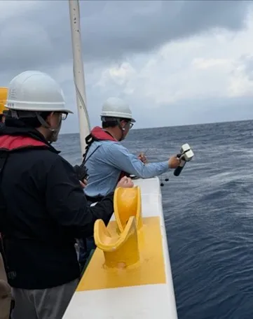
After the test was completed, we finally headed for the mode water observation area. Considering the stormy weather expected later in the day, the observation area was changed to a relatively closer location than originally planned. On the way to the observation area a few hundred km southeast from Hachijojima, we conducted several observations using XCTD, an expendable temperature and salinity observation device, to confirm whether mode water existed in the area and how it changed as we moved east.
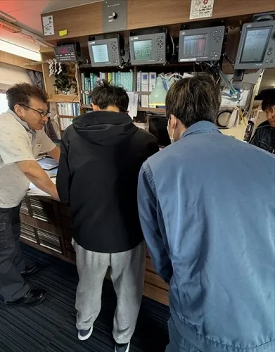
We arrived at the station early in the morning of May 5, where we conducted CTD observations and multilayer water sampling to capture mode water in detail, including temperature, salinity, depth, phytoplankton, zooplankton using a state-of-the-art camera, carbonic acid, alkalinity, pH, and nutrients.
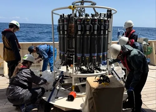
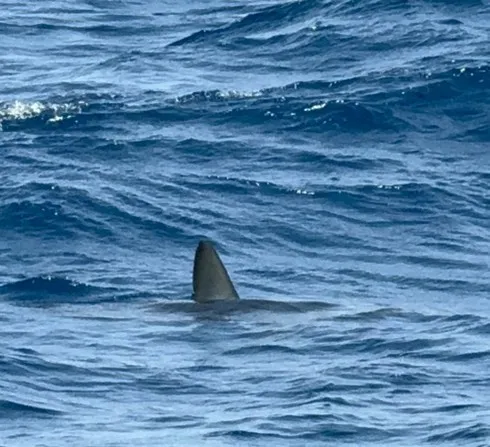
After the CTD observation, it is time to deploy the four autonomous floats. TUMSAT, to which the authors belong, will deploy a turbulence measurable float, that is from the A02-4 group of Habitable Japan. Before we deploy the floats, we received an unexpected welcome. Some students were cheered and I thought it might be dolphins, but then a shark swam by with its dorsal fins up, and we were a little worried that the float might be bitten. This is because another instrument, a free-fall turbulence profiler, had been pulled violently when it was being recovered in the south of Kyushu before, and when it managed to come back on deck, it had huge teeth marks on it.
At first, this float was scheduled to be the second to be deployed, but during the previous test, the float buoyancy remained low and it took about 20 minutes to maximize the buoyancy, so our float ended up being the last to be deployed.
Subsequently, turbulence observations were conducted in the deployment area using a free-fall turbulence meter in order to compare the turbulence data with the turbulence measurable float. Observations were also made using a camera-mounted biochemical profiler to compare the data with that of a float equipped with a zooplankton camera.
However, as expected, the weather gradually worsened and the Shinsei Maru left the observation area and evacuated to Tateyama Bay. After evacuation, the Shinsei Maru left Tateyama Bay on May 7 to recover two floats, and headed back to the observation area with the swell still lingering.
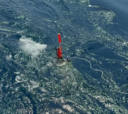
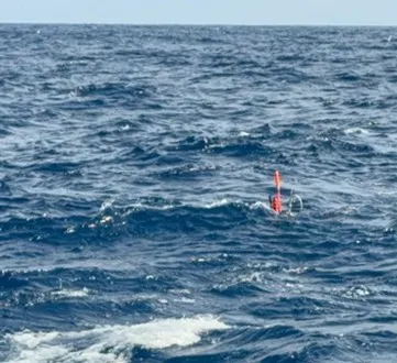
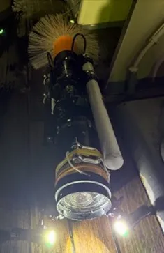
The autonomous turbulence measurable float was set up to sink to 1500 meters for the first profile and 700 meters from the second and subsequent profiles, then rise to the surface while measuring multiple parameters including turbulence. Then, transmit data via hygienic iridium communication at the surface, and repeat the cycle of slowly sinking to the deepest point and rising again. When the float surfaces, it can read commands from a server on land and modify the settings for the next cycle, so we can access the server from the ship, place a file with the commands, and change the settings. After observing up to 1500-m before retrieval, we modified the settings to allow the float to drift on the surface of the ocean and send position information every 10 minutes to the server. Ten minutes after surfacing and communicating the float’s surfacing position to the bridge, the float seemed to be visually visible to the bridge. This was surprising since it usually took 1-2 hours to find the float. The red tape and reflector wrapped around it, as shown in the photo, was very effective.
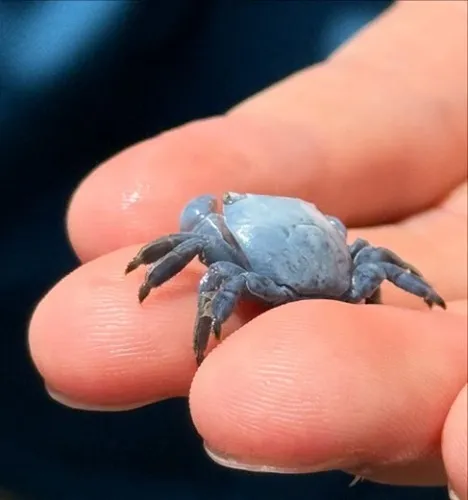
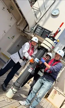
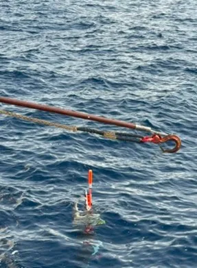
The Tohoku University float then surfaced a few hours later, and we were able to retrieve it as well after making a CTD observation before that. The Tohoku University float had a crab passenger, and we all wondered when he boarded the float. Perhaps it was because he piloted the vehicles that the recovery of the two vehicles went smoothly.
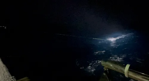
We then conducted nighttime free-fall tow-yo observations from the stern using turbulence and biochemical profilers. There were many jellyfish attached to the rope, which “smelled” that biological production was relatively high in this subtropical area during the May bloom season. Come to think of it, there were also a relatively large number of seabirds flying around, checking out what was coming up, thinking we were catching fish at the stern.
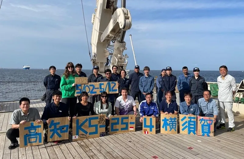
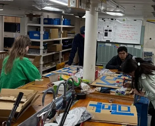
The weather then turned bad again and we had to evacuate to Tateyama Bay, but the weather did not improve quickly enough after that, and we decided to end this cruise with this tow-yo observation. The day before the final day, we wrote the name of the voyage and other information and drew pictures to commemorate the event.
Thank you all for your hard work in observation. I would like to thank Captain Aoki, c/o Kato, Second Officer Kikuchi, all the deck hands (especially for untangling the tangled rope of the winch I brought in and for pulling up the instrument by hand for 400m), the kitchen staff for preparing delicious meals, and float operation land supporters.