A01-K103 Extract and evaluate rapid changes of the Kuroshio that cannot be detected by conventional observations
A01-K103
Principal Investigator
| ICHIKAWA Kaoru | Kyushu U. |
Research Collaborators
| YUFU Kei | Kyushu U. |
| NODA Jyoshiro | Kyushu U. |
| MIYACHI Yukino | Kyushu U. |
| SAKEMI Ryosuke | Kyushu U. |
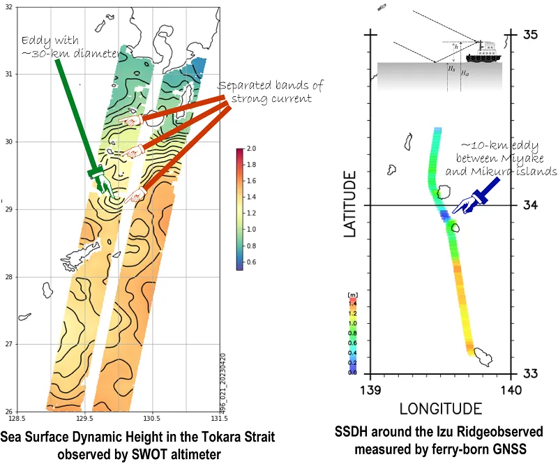
Satellite remote sensing is useful to observe variations of wide oceans. Especially, satellite altimeters observing sea surface height undulations are most vital to obtaining ocean current variations. However, because the temporal and spatial resolutions of satellite altimeters are not fine enough, rapidly changing small phenomena, such as small meanders in the Kuroshio, cannot be captured.
Therefore, daily Global Navigation Satellite System (GNSS) data collected from ferryboats crossing the Tokara Strait and around the Izu Ridge will be used to extract rapid changes in Kuroshio’s sea surface dynamic height (SSDH). Furthermore, combining with the fine SSDH spatial structures observed by the brand-new SWOT altimeter, the effects of the Kuroshio’s rapid changes on the ocean, atmosphere, and biosphere will be examined.